


Cities in full color: How hyperspectral imaging is rewriting what we know about urban materials
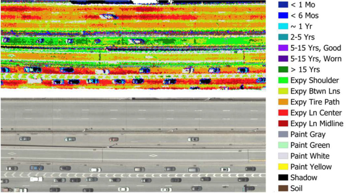
This article explores how hyperspectral imaging is transforming infrastructure monitoring. It explains how advanced airborne sensors, including those developed by ITRES Research Limited, help detect material degradation, moisture intrusion, thermal anomalies, and structural stress before visible failure occurs. The feature
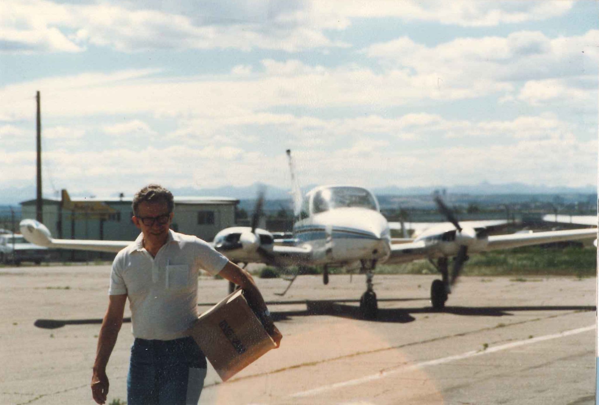
In Memory of Dr. Clifford Anger
Trained as a physicist, Dr. Anger’s early work in space and atmospheric science included pioneering research on auroral emissions and key contributions to the Galileo and Viking missions, applying imaging and spectroscopy to understand planetary environments. That experience fostered a
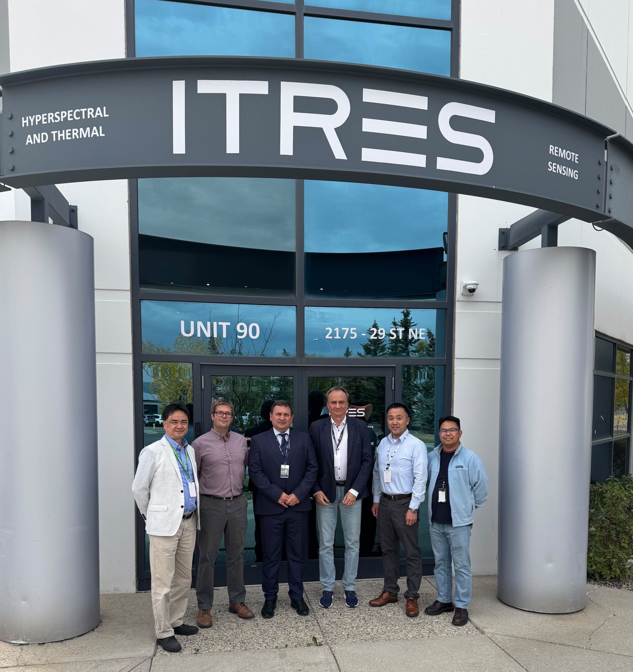
National Forest Centre in Slovakia expands airborne capabilities with ITRES high-fidelity hyperspectral sensors
The National Forest Centre (NFC) in Slovakia enhances its airborne sensing capabilities with two High-Fidelity ITRES hyperspectral sensors, advancing sustainable forest monitoring, ecosystem assessment, and precision resource management through cutting-edge remote sensing technology.
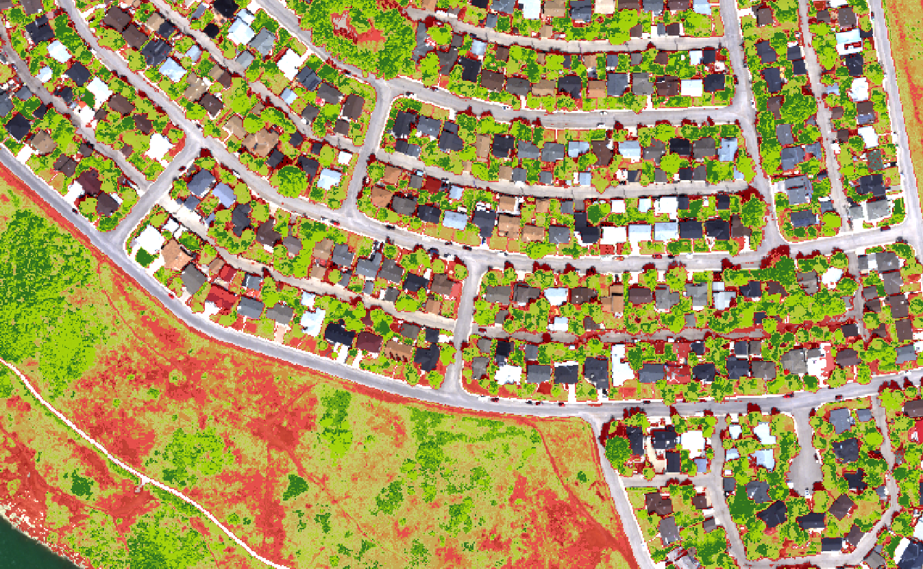
How sensor fusion is transforming aerial mapping – Featuring ITRES
The article “Sensor Fusion Transforms Aerial Mapping” (by Ada Perello, GIM International, Issue 4, 2025) explains how modern aerial mapping now combines multiple sensors to create far more detailed, useful, and accurate maps of our world. Traditionally, airplanes carried one