


How sensor fusion is transforming aerial mapping – Featuring ITRES
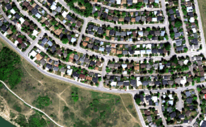
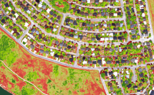
A recent GIM International article highlights the rising demand for detailed chemical and physical properties of vegetation, as well as smarter detection algorithms, sensor fusion represents the next frontier in aerial mapping uniting multiple sensing technologies to achieve unprecedented detection accuracy.
The article showcases real-world projects, from detecting olive tree diseases in Italy to mapping underwater habitats in the Great Lakes. Powered by ITRES’ CASI-1500 hyperspectral and microTABI-640 thermal sensors. Through sensor fusion, these technologies capture more than images, they uncover hidden patterns that drive smarter decisions across agriculture, conservation and infrastructure.
Click here for the complete story: GIM International 2025 Issue 4